Floods & Disasters
Floods
The original 70-acre village of Highspire that Berentz and Dochterman laid out in 1814 was located in a flood plain along the Susquehanna River. While this location may have been advantageous for access to early transportation routes, it would subject the community to many floods over the years.
There were no records of Susquehanna River water level measurements and floods when Highspire was founded. However, there are records, but no measurements, of a “Pumpkin Flood” of October 1786, when pumpkins washed from nearby fields and filled the river. The first flood with a record of the crest was in March 1846. The table below is a National Weather Service list of all floods, along with their crests, from 1846 through 2018. The crest levels are for Harrisburg and should, with one exception in 1904, accurately reflect the severity of flooding in Highspire.
There were no records of Susquehanna River water level measurements and floods when Highspire was founded. However, there are records, but no measurements, of a “Pumpkin Flood” of October 1786, when pumpkins washed from nearby fields and filled the river. The first flood with a record of the crest was in March 1846. The table below is a National Weather Service list of all floods, along with their crests, from 1846 through 2018. The crest levels are for Harrisburg and should, with one exception in 1904, accurately reflect the severity of flooding in Highspire.
Flood stage at Harrisburg is 17 feet
Date of Flood Crest (ft.) Streamflow (cfs) Category*
3/15/1846................... 22.00.................... 482,000................ Moderate
3/18/1865................... 24.60.................... 573,000..................... Major
3/19/1868................... 20.00.................... 417,000................ Moderate
1/6/1886..................... 19.02.................... 385,000.................... Minor
6/2/1889..................... 26.80.................... 654,000.................... Major
2/19/1891................... 19.70.................... 408,000.................... Minor
5/22/1894................... 25.70.................... 613,000..................... Major
3/3/1902..................... 22.94.................... 449,000................ Moderate
3/8/1904..................... 20.84.................... 298,000................ Moderate
3/3/1910..................... 17.20.................... 332,000..................... Minor
3/28/1913................... 19.54.................... 402,000..................... Minor
3/30/1914................... 18.10.................... 358,000..................... Minor
3/29/1916................... 18.80.................... 379,000..................... Minor
3/13/1920................... 20.20.................... 423,000................ Moderate
4/8/1924..................... 17.00.................... 324,000..................... Minor
2/13/1925................... 18.80.................... 379,000..................... Minor
11/17/1926................. 17.00.................... 323,500..................... Minor
3/19/1936................... 29.23.................... 740,000..................... Major
4/2/1940..................... 19.75.................... 418,000..................... Minor
1/1/1943..................... 19.40.................... 412,000..................... Minor
5/29/1946................... 21.80.................... 494,000................ Moderate
11/27/1950................. 19.34.................... 416,000..................... Minor
4/2/1960..................... 18.20.................... 382,000..................... Minor
2/27/1961................... 18.48.................... 392,000..................... Minor
3/12/1964................... 21.51.................... 484,000................ Moderate
2/16/1971................... 18.03.................... NA............................ Minor
6/24/1972................... 33.27.................... 1,020,000.................. Major
2/26/1975................... 18.19.................... 375,000..................... Minor
9/27/1975................... 23.82.................... 529,000..................... Major
3/7/1979..................... 20.43.................... 416,000................ Moderate
2/5/1982..................... 17.64.................... NA............................ Minor
12/15/1983................. 17.55.................... 328,000..................... Minor
2/16/1984................... 20.74.................... 426,000................ Moderate
4/7/1984..................... 18.88.................... 368,000..................... Minor
3/16/1986................... 18.53.................... 357,000..................... Minor
4/2/1993..................... 20.50.................... 410,000................ Moderate
3/26/1994................... 17.90.................... 334,000..................... Minor
1/20/1996................... 25.08.................... 568,000..................... Major
1/10/1998................... 17.27.................... 316,000..................... Minor
9/19/2004................... 24.40.................... 557,000..................... Major
3/30/2005................... 17.43.................... 321,000..................... Minor
4/4/2005..................... 18.87.................... 360,000..................... Minor
6/29/2006................... 19.66.................... 383,000..................... Minor
3/6/2008..................... 17.44.................... 321,000.................... Minor
3/12/2011................... 20.09.................... 397,000................ Moderate
4/29/2011................... 18.37.................... 346,000..................... Minor
9/9/2011..................... 25.17.................... 590,000..................... Major
7/26/2018....................17.32..................... 318,000.................... Minor
*Flood Categories (in feet)
Major Flood Stage: 23
Moderate Flood Stage: 20
Flood Stage: 17
Action Stage: 11
Low Water Records
(1) 1.83 ft. on 09/13/1964
(2) 2.46 ft. on 09/25/1963
(3) 2.48 ft. on 11/29/1930
(4) 2.59 ft. on 09/28/1959
(5) 2.67 ft. on 11/06/1964
Sources: National Weather Service, National Oceanic and Atmospheric Administration (NOAA),
U.S. Department of Commerce
Forty-eight floods are listed in the table. That is an average of one every 3.6 years since 1846. The longest spell between floods was a 19-year period between 1846 and 1865. The second-longest was between 1868 and 1886. In the 20th century there were two 10-year periods between floods, 1926 to 1936, and 1950 to 1960. There have been 26 floods since 1960, or about every 2.3 years. The frequency of flood events seems to be increasing.
Nine of the 48 floods were categorized as major, with a crest of 23 feet or higher at Harrisburg. Those floods were in 1865, 1889, 1894, 1936, 1972, 1975, 1996, 2004 and 2011. The longest period between major floods was 42 years, from 1894 to 1936. The next longest interval was 36 years, from 1936 to 1972. There have been five major floods since 1972, or about one every eight years. Major floods have been more frequent in the last half century.
After the major flood in 1894, an obelisk monument with the high-water mark of that flood was placed near the old railroad freight station along Railroad Street. After that area was redeveloped as an industrial zone, the monument was moved to the back yard of the Wilson House along Lusk Avenue.
One flood that was unique to Highspire was that of March 1904. There was a moderate flood on the Susquehanna with a crest of 20.84 feet at Harrisburg. But that winter was also one of the coldest on record, and when the ice on the river began to thaw and break up as the water level rose, ice freshets were created on the Susquehanna. An ice jam began to form at the lower end of Highspire. The Patriot of Feb. 28, dateline Highspire, reported: “The ice gorge at this point looks to be of a serious nature. The ice is piled up in some places to more than twenty-five feet high.” On March 4, the Harrisburg Telegraph reported, “At 2:30 o’clock this afternoon, the gorge at Highspire had extended clear across the river and was fifty feet high, gaining in height rapidly.” The next day, the Telegraph reported: “Highspire is in the throes of its worst flood and the town is practically paralyzed. From the canal bridge to the lower end of the town the village is submerged in an ice floe which covers all field fences and reaches the first story windows in many homes. The record of 1889 (26.80 feet at Harrisburg) is passed by twenty-five inches, and at several places three feet.” A later report in the same issue of the Telegraph stated that “at 2:30 o’clock this afternoon, the immense ice gorge at Highspire, some distance below the Bodmer House, broke with a roar and the ice is moving out rapidly. … In thirty minutes the water fell three feet. … At Steelton, the water receded eight inches in five minutes”
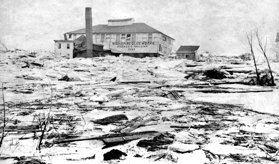
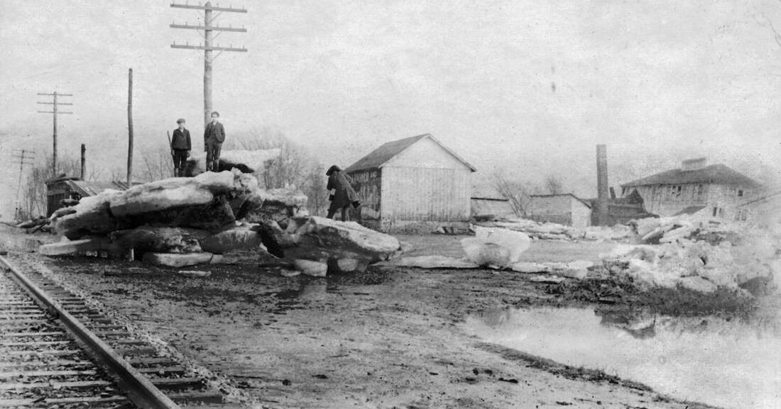
As the ice moved out with the flood waters, it damaged structures in its path. In Highspire, the Glue Factory along the river just west of Burd Run was destroyed. The railroad tracks were covered with ice and were impassable. The Pennsylvania Railroad employed between three and four thousand men to remove ice that was piled as thick as twelve feet in places. Immediately after that flood the Pennsylvania Railroad made a decision to raise its main passenger track on an embankment along the river to help prevent similar events in the future. The project was completed within a year, and a new Highspire passenger station was built beside the elevated track at the foot of Railroad Street.
This view of the Highspire Glue Works immediately after the 1904 ice-jam flood from a point near the railroad tracks looking toward the Susquehanna River. The building was knocked off its foundation.
In the aftermath of the 1904 flood, large chunks of ice were left piled along the railroad tracks.
This view is from near the large Highspire Distillery (Hartman) warehouse looking southeast.
The Glue Works is visible in the distance to the right.
This view is from near the large Highspire Distillery (Hartman) warehouse looking southeast.
The Glue Works is visible in the distance to the right.
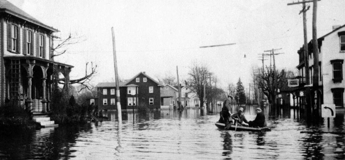
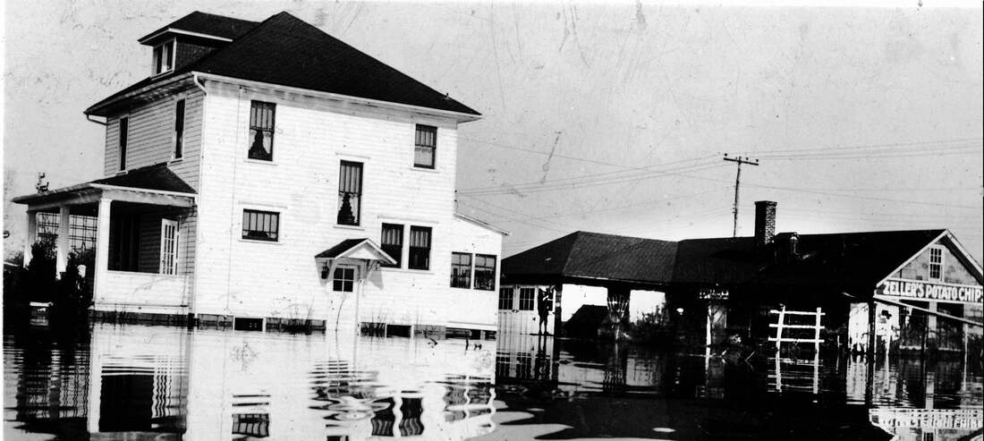
The first major flood in the memory of any living Highspire resident or ex-resident is the Flood of 1936. Its crest at 29.23 feet at Harrisburg set a record. It is fair to say that most Highspire residents thought that was the flood of a lifetime, and that the crest was unlikely to ever be exceeded. More than half the land area of the borough was under water. Second Street was under water from Vine Street down to Hammaker Street, and the flood waters crossed Penn Street around Burd Run and Lumber Street.
This view of Second Street during the 1936 flood is near the Wilson House, looking east toward Middletown. The Bodmer House, on the southeast corner of Second and Lumber streets, is to the right. Eva Stoner’s house is on the left.
The house on the left was Paul and Cora Zeller’s home at 434 Eshleman St. The potato chip factory behind the house is to the right in this 1936 flood photo.
Jacob Myers stands in flood waters in front of the Knight’s Candy Store on Broad Street in 1936. This view is looking east. The old fire station is on the right. The Boat House, or Boatman’s Rest, is in the distance at the end of Broad Street. lick here to edit.
Much to the surprise of most Highspire residents, the ’36 Flood turned out to be the flood of half a lifetime. While Hurricane Agnes technically was a hurricane for only a short time as it crossed the Caribbean in June 1972, it became a massive, slow-moving tropical storm that pounded Central Pennsylvania with intense rain. Agnes poured seven or more inches over most of Pennsylvania. Rainfall in Central Pennsylvania exceeded ten inches, with some areas receiving as much as nineteen inches. Agnes is listed as the wettest tropical cyclone on record for Pennsylvania. More than 68,000 homes and 3,000 businesses were destroyed, and more than 220,000 people were left homeless in the state. Agnes caused $2.8 billion (1972 dollars) worth of damage and 50 deaths in Pennsylvania. In Harrisburg, Agnes flood waters crested at 33.27 feet on June 24, 1972, four feet above the 1936 crest. At its crest, more than one million cubic feet per second of water was flowing past Harrisburg. In Highspire, virtually the whole town was underwater, except for the hill areas at the west end of town.
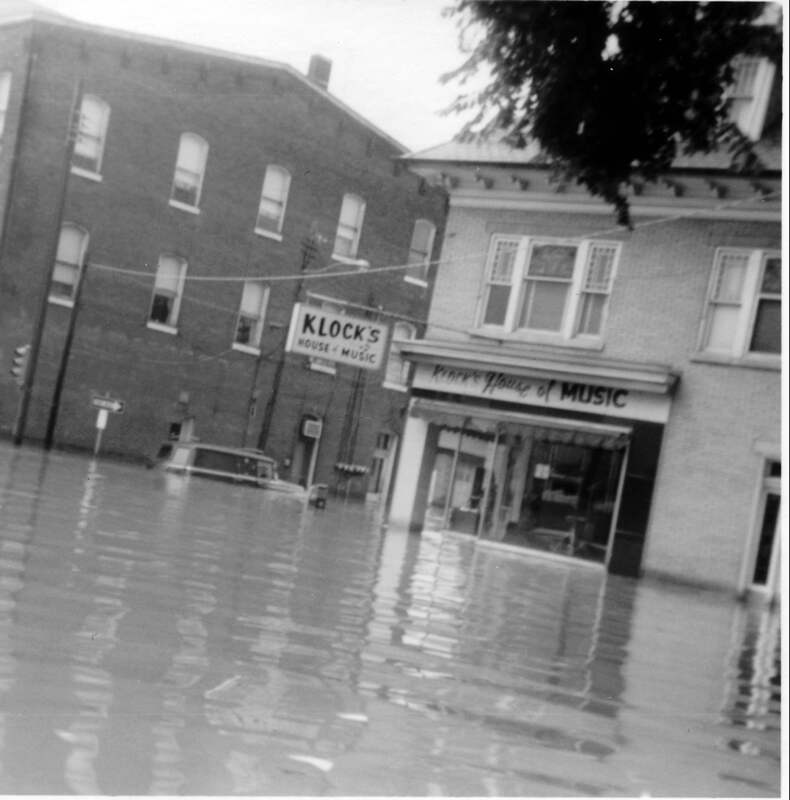
Muddy water from the 1972 Hurricane Agnes Flood covers the intersection of Roop, Broad and Second streets. This view is from in front of Achenbach’s Drug Store on Second Street.
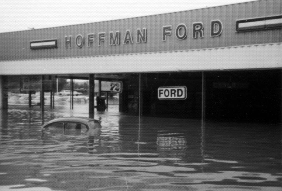
The Hoffman Ford show room at 427 Second St. was engulfed during the 1972 flood. After a second major flood in 1975, owner Earl Hoffman decided to move to higher ground in Colonial Park.
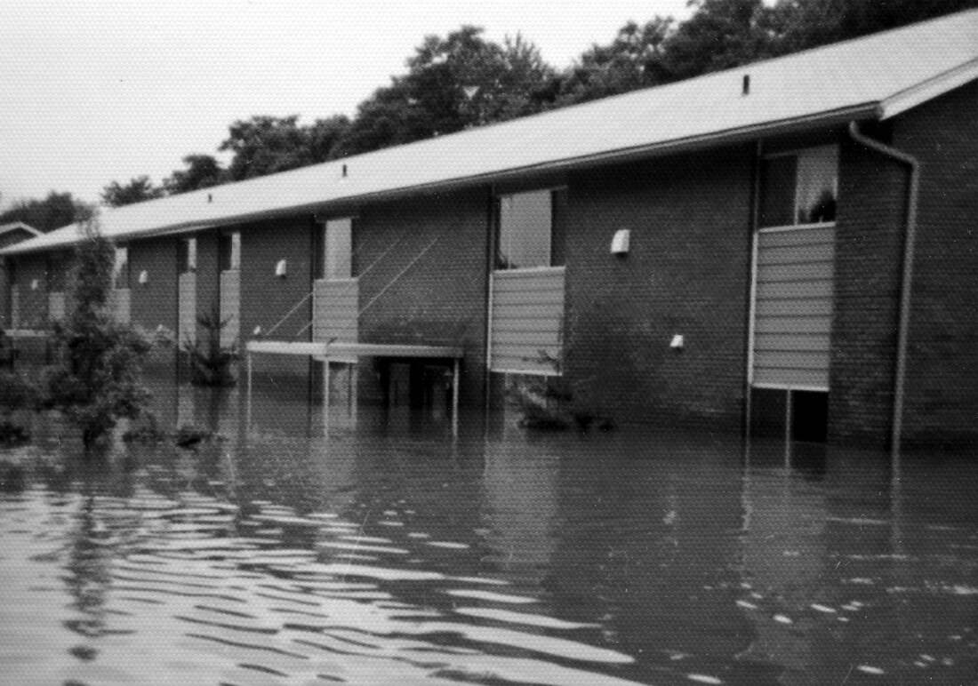
Flood waters during 1972 rose well into the first floor of the Willow Garden Apartments on Willow Street, on the east end of town.
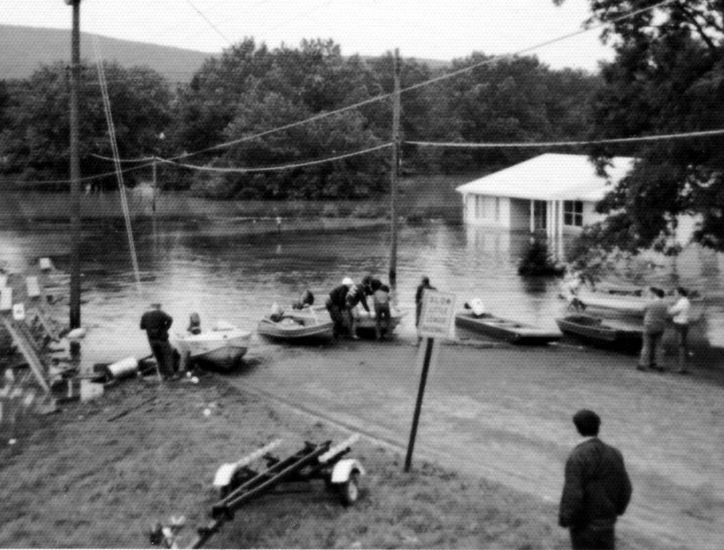
Ann Street became a temporary boat ramp during the 1972 flood. The water’s edge would be about where the upper entrance to the Highspire Apartments is today.
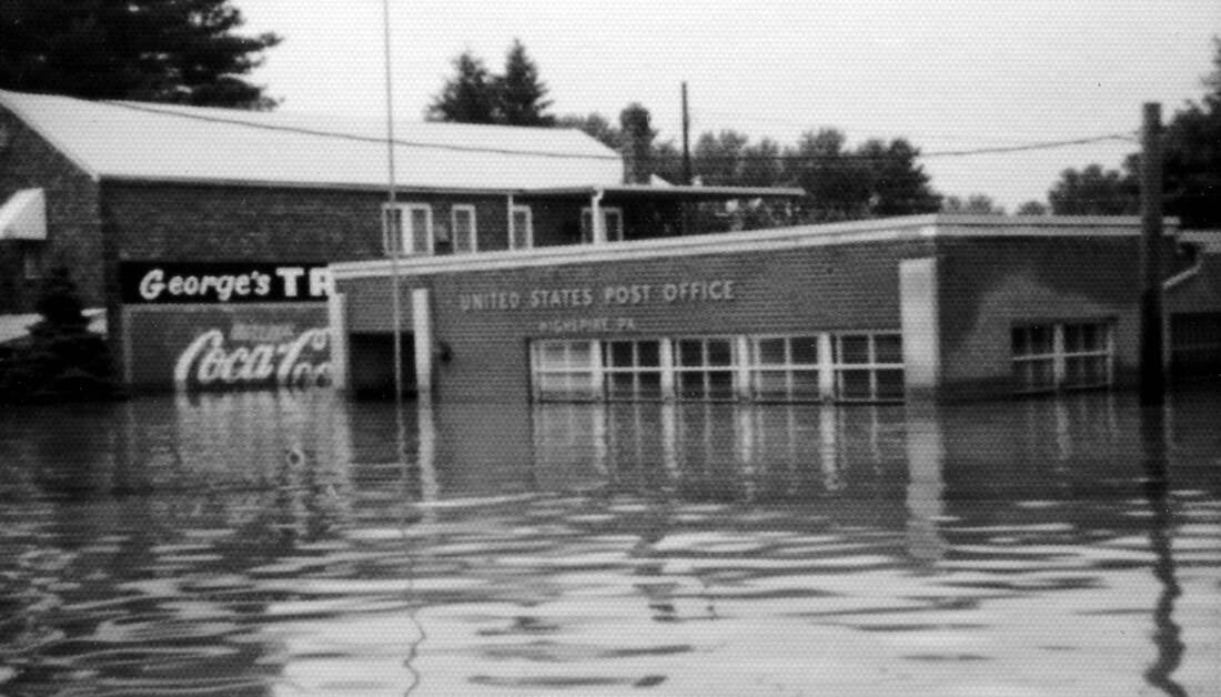
This 1972 view of the inundated Highspire post office on the north side of Second Street is from a point approximately in front of the current post office. The lot now is part of Champions Sports Bar.
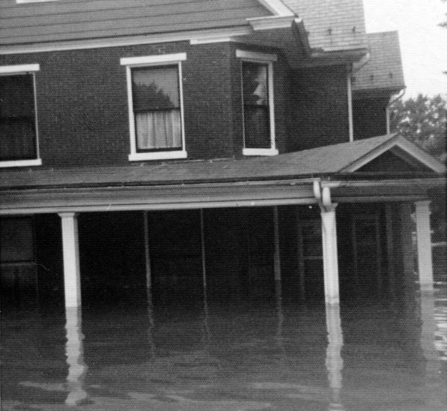
Flood waters surround this house is on the northeast corner of Eshleman and Hammaker streets.
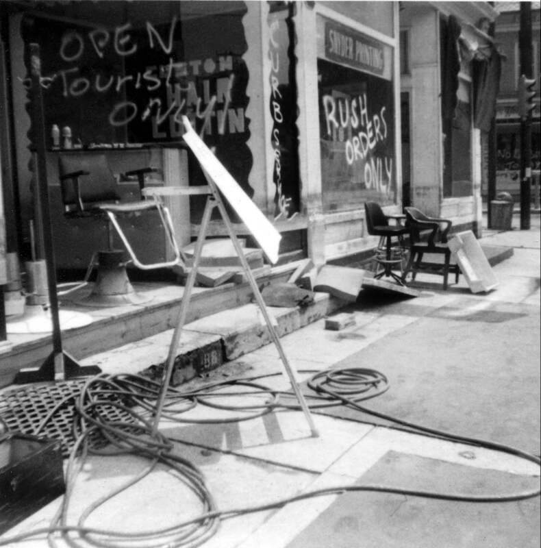
Businesses on the northwest corner of Second and Roop streets undergo cleanup after the 1972 flood.
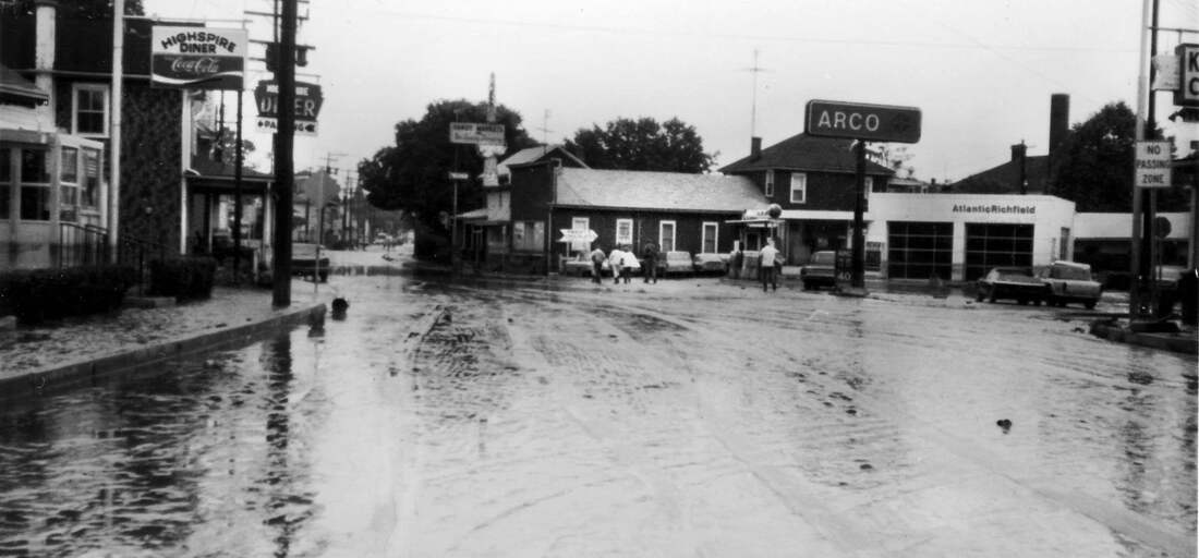
When the water receded after the 1972 flood, everything was coated with a layer of mud. This view is looking west on Second Street from a point just east of the intersection with Paxton Street.
Hurricane Agnes led to major changes in Highspire. The old residential areas on Front and Water streets dating to the beginning of the town in 1814 were acquired by the Dauphin County Redevelopment Authority, and all borough land south of Lusk Avenue on the west end of town was zoned as an industrial area. All the buildings on the southeast corner of Commerce and Second streets, in Highspire’s old commercial center, were razed and replaced with a small strip mall. Similarly, the Highspire Hotel on the southeast corner of Second and Lumber streets, dating to at least 1850, was razed and replaced with a small strip mall. The two-story frame houses on Broad Street east of Chestnut Alley, dating back at least a century, were razed and replaced by town houses, with garages on the ground floor. Broad Street was realigned to connect to Lumber Street, eliminating the Broad Street bridge over Burd Run. Some businesses, especially after another major flood in 1975, relocated to less risky locations. By the mid-1980s, Highspire looked quite different than it did before Agnes.
Fires
In the 19th century when wood and coal fires were used for heating and cooking, and oil lamps and candles were used for light, structure fires were more common than they are today. Fires also were much more difficult to fight before modern water distribution systems and fire hydrants, motorized fire apparatus and communication and alarm systems. One of Highspire Borough’s first priorities when it was incorporated in 1903 was to establish better fire protection for the community.
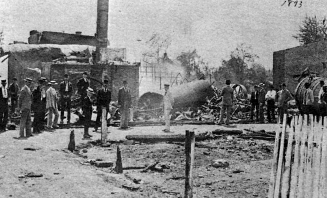
Perhaps the most famous Highspire conflagration was the Highspire Distillery fire of 1893. That blaze completely destroyed the production and office facilities of the distillery, but the main whiskey storage warehouses were saved. The fire gave rise to the popular story of whiskey flowing out to the river and burning on the water with a blue flame. William Kaylor, who worked at the distillery, told the story of a man who drank the whiskey as it flowed out of the “trough,” and died the next day.
Perhaps the most famous Highspire conflagration was the Highspire Distillery fire of 1893. That blaze completely destroyed the production and office facilities of the distillery, but the main whiskey storage warehouses were saved. The fire gave rise to the popular story of whiskey flowing out to the river and burning on the water with a blue flame. William Kaylor, who worked at the distillery, told the story of a man who drank the whiskey as it flowed out of the “trough,” and died the next day.
This shows the aftermath of the 1893 Highspire Distillery fire. The distillery’s production facilities were completely destroyed, but its biggest asset, whiskey aging in the warehouses, was saved.
(Photo from the Sesqui-Centennial book “The Story of Highspire”)
(Photo from the Sesqui-Centennial book “The Story of Highspire”)
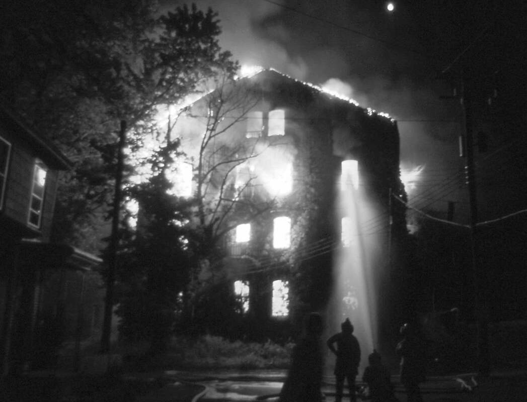
Ten years later, in 1903, a fire fanned by high winds destroyed ten houses in an area known as Mumma’s Row, leaving many families homeless and destitute. In December 1916, the original St. Peter’s Lutheran Church on Penn Street was destroyed by fire. In 1917, much of the borough was threatened by a major fire that started in a three-story flour and feed warehouse on the south side of Front Street. The blaze destroyed that facility and three adjacent houses. The A.J. Hoke coal yard, coal shed, office building and scales, just across a small alley, also were destroyed, along with thousands of dollars’ worth of fuel. High wind blew embers more than a thousand feet onto the roof of a house owned by Michael Stoner on the northeast corner of Second and Lumber streets — where Champions is today — starting a fire that completely destroyed the house. One of the last major structural fires, in July 1974, destroyed the abandoned Highspire Distillery buildings.
The former Highspire Distillery building at the east end of Front Street was destroyed by fire in 1974. (Photo by Robert Keifer, courtesy of nephew Don Ruth)
Disasters
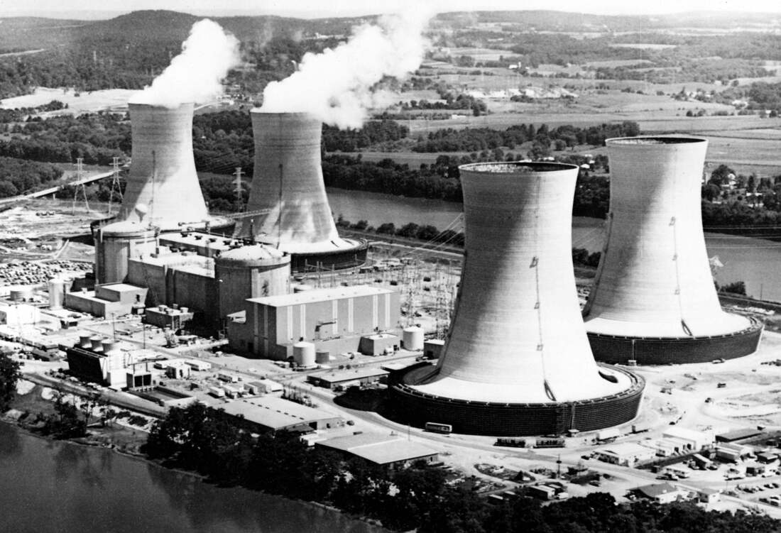
Being on the banks of the Susquehanna River, Highspire has had a full measure of natural disasters, but in 1979 Highspire was visited by a man-made disaster in the partial meltdown of the Three Mile Island Unit 2 nuclear reactor. The accident started in the early hours of Wednesday, March 28, 1979, with equipment failures and operator errors that allowed large amounts of nuclear reactor coolant water to escape. Initial reports were that the event was not serious and the public was not in danger. However, that assessment quickly changed. Schools were closed, residents were urged to stay indoors, and Gov. Richard Thornburg advised evacuation of pregnant women and children within a five-mile radius of Three Mile Island. On Friday, the evacuation zone was extended to 20 miles. It is estimated that 140,000 residents, including many from Highspire, left the area. However, the majority of the 660,000 population within the 20- mile radius stayed in the area. In Highspire, many businesses stayed open. Almost all of the evacuees returned to their homes within a few weeks.
Three Mile Island Unit 2, on the right, suffered a partial meltdown in March 1979. Highspire, a short distance upriver, was in the evacuation zone.
The experts determined that the radioactive material released from the Unit 2 partial meltdown did not expose residents to dangerous levels of radiation. However, the incident was extremely disruptive of daily life in the region. According to the watchdog group Three Mile Island Alert, the plant operator and its insurers paid more than $82 million in publicly documented compensation to residents for loss of business revenue, evacuation expenses and health claims. Also, hundreds of out-of-court settlements have been reached with alleged victims of the fallout, with a total of $15 million paid to parents of children born with birth defects.
The Three Mile Island accident was a wakeup call to the nuclear industry in the U.S. It virtually stopped construction of nuclear power plants. Highspire came very close to being an uninhabited nuclear wasteland like the areas around the Chernobyl Nuclear Plant in Ukraine and the Fukushima Daiichi Nuclear Plant in Japan.
The Three Mile Island accident was a wakeup call to the nuclear industry in the U.S. It virtually stopped construction of nuclear power plants. Highspire came very close to being an uninhabited nuclear wasteland like the areas around the Chernobyl Nuclear Plant in Ukraine and the Fukushima Daiichi Nuclear Plant in Japan.
