Beginning
Before 1814
Little is known for certain about the Native American occupation of the land that became present-day Highspire, PA. Some experts believe the archeological evidence points to a large Susquehannock village there.
Archeological excavations on Calver Island prior to the 2005 start of construction of the new Pennsylvania Turnpike Bridge across the Susquehanna River revealed prehistoric occupations spanning the period 2,600 to 5,200 years ago. The report identified Calver Island as “a remarkable prehistoric site,” with the best intact record of prehistoric occupations in Dauphin County.
European occupation of Highspire began in the early 18th century. In 1705, John Harris Sr. received a license to operate a trading post on the Susquehanna. In 1733, he was granted a right to operate a ferry across the river at present-day Harrisburg.
In 1751, Hugh Davey was granted warrants for two tracts of about 250 acres along the Susquehanna River that encompass present-day Highspire. The warrants authorized surveys and initiated the process of transferring title of the land from the Penn family to private ownership. The surveys were recorded in 1755, and the patents conveying clear title to the first private owners, William Clinton and John Ladlie, were issued Jan. 1, 1761.
Perhaps the most famous 18th century resident of the area that would become Highspire was Colonel James Burd. He was a prominent military commander in the French and Indian War and was a contemporary of George Washington.
According to the book “James Burd, Frontier Defender” by Lily Lee Nixon, on Aug. 4, 1766, Burd “bought at Vendue 500 Acres of Patented Land which belonged to Clinton’s Estate, fronting the River Susquehanna for £900 with a new Saw Mill on it, but the Stream of water not very Constant … there is a very good Log House, and a large Log Barn 50 X 30 feet 2 stories high….2 miles from Middletown.”
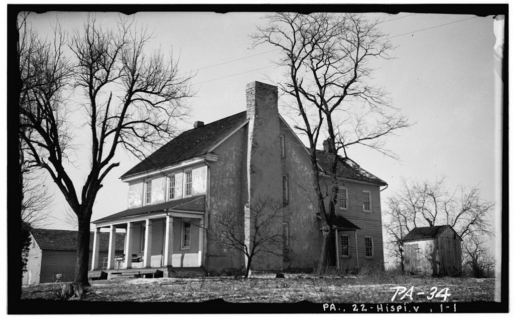
In another source, Burd Run is identified as the western boundary of the Tinian plantation. The log house sat on high ground looking out over the Susquehanna River Valley. Large oak trees shaded a lane leading down to the river. Burd named the property Tinian. In April 1768, a new large, stone plantation house was completed on the property. After settling in at Tinian, Burd served as justice of the peace and his home functioned as a courthouse and jail, and as a bank for safe storage of neighbor’s gold and silver. Burd’s Tinian home still stands at 2051 Rosedale Ave., just outside the borough limits.
Tinian, 1936, Library of Congress Photograph
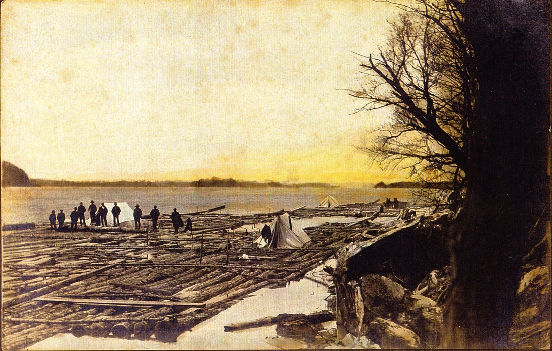
While commerce and industry are important to any community, Highspire’s history has been most influenced by transportation. Rivers were the equivalent of interstate highways for Native Americans. The Susquehanna River was the main route for moving goods to market from North Central Pennsylvania until the advent of canals and railroads. Prior to 1791, downriver navigation stopped at the Swatara Creek due to the rapids between the Swatara Creek and the Chesapeake Bay. In that year, a young miller named Michael Cryder descended from Huntingdon on the Juniata River in a flat-bottomed ark filled with flour. Rather than offload his flour for travel overland to eastern markets, he chanced the rapids, arriving safely at Baltimore, where he was amply rewarded for his risk.
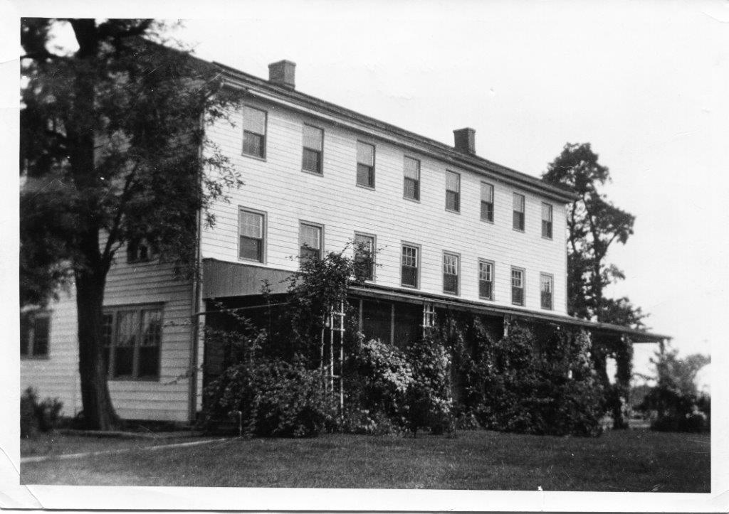
After Cryder successfully navigated the lower Susquehanna, this practice became common during spring and fall high water. In 1797, Thomas Burbridge of Wyoming, PA, ran 99 arks loaded with coal in just one season. However, some cargo failed to reach its destination for lack of skilled pilots to navigate the rapids. The demand for pilots quickly grew, and the White House at the end of White House Lane on the east end of present day Highspire became the headquarters for pilots hired to guide rafts and boats down the lower Susquehanna.
After Cryder successfully navigated the lower Susquehanna, this practice became common during spring and fall high water. In 1797, Thomas Burbridge of Wyoming, PA, ran 99 arks loaded with coal in just one season. However, some cargo failed to reach its destination for lack of skilled pilots to navigate the rapids. The demand for pilots quickly grew, and the White House at the end of White House Lane on the east end of present day Highspire became the headquarters for pilots hired to guide rafts and boats down the lower Susquehanna.
Log Rafts tied up along shore of the Susquehanna, late 19th Century
The White House circa 1920 at the end of White House Lane overlooked the Susquehanna River.
Highspire also is located along what had been a key 18th century land transportation route. The King’s Highway from Philadelphia to Pittsburgh and Ohio was laid out in 1730. Locally, this route became the Harrisburg-Lancaster Turnpike and today is Pennsylvania Route 230.
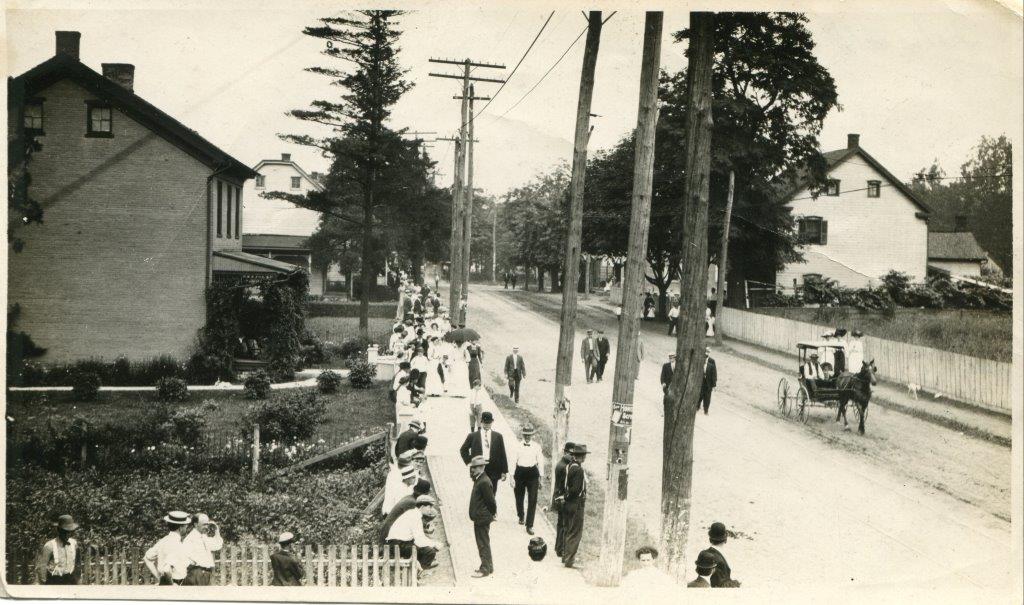
There was a tavern and resting place on the turnpike known as the Cross-Keys Inn. It was located about where the social room of the Highspire Citizens Fire Company No. 1 is today. Around the turn of the 19th century, the inn was owned and operated by Jacob Early. Jacob died in 1806 and his wife, Catherine, succeeded him as proprietor of the Cross-Keys. In October 1807, the estate consisting of approximately 15 acres with the inn was sold to Conrad and Mary Alleman.
There was a tavern and resting place on the turnpike known as the Cross-Keys Inn. It was located about where the social room of the Highspire Citizens Fire Company No. 1 is today. Around the turn of the 19th century, the inn was owned and operated by Jacob Early. Jacob died in 1806 and his wife, Catherine, succeeded him as proprietor of the Cross-Keys. In October 1807, the estate consisting of approximately 15 acres with the inn was sold to Conrad and Mary Alleman.
This photo was taken from the second floor of the Bodmer House on the southeast corner of Second and Lumber Streets on July 4, 1910. The Cross-Keys Inn was the white house on the right of the photo.
Highspire
On Dec. 23, 1813, Conrad and Mary Alleman sold the same tract of land to Henry Berentz of Marietta, PA, and Michael Dochterman of Mount Joy Township, PA. Henry Berentz and Michael Dochterman were German immigrants. The 15-acre tract ran from about a half block below Lumber Street on the east to Railroad Street on the west, and from the river on the south to about a half block beyond the Harrisburg-Lancaster Turnpike (Second Street) on the North. They quickly laid out a town that they called Highspire, divided into about sixty 40-foot-wide by 200-foot-deep building lots. The first lots were sold in January 1814.
On April 2, 1814, Berentz and Dochterman purchased an adjoining 56 acres from John and Barbara Bishoff (or Bishop). This tract ran approximately from Railroad Street to Race Street and was bounded on the north by Vine and Second streets, and on the south by the river. It was laid out in about 135 lots that were 40-feet wide, with depths varying from 160 to 230 feet. This tract they called High Spire Continued. Highspire was spelled as two words in the deeds for the second parcel.
Land development has always been a risky business. The Highspire Historical Society has a number of deeds for the original lot 147. It sold in August 1814 for $350, roughly equivalent to $4,000 in today’s dollars. Within five years, Berentz and Dochterman had filed for bankruptcy.
The original buyer of lot 147 must have defaulted, because the lot was sold for $25 in August 1819 by John Garver, the “appointed trustee of the estate of said insolvents.” The 1819 deed explains that Berentz and Dochterman filed for bankruptcy. Part of the huge drop in price was due to deflation in the intervening five years; the value of the dollar had increased by almost 40 percent. But the majority of the price drop was due to insufficient demand for lots in Highspire. Obviously, income from the sale of lots fell short of their expectations.
The origin of the name Highspire is unknown. A popular story is that the town was given the name because a church steeple could be seen from the Susquehanna River. This story most often cites the Church of God on the west end of town. But that certainly is a myth. The first church organized in Highspire was the United Brethren, which was formed in 1793 or 1794. At the time Berentz and Dochterman gave the town its name, the members of that church were meeting in private homes. The first church building was dedicated in 1842. The meeting house of the Church of God was built in the same year. It is possible that another structure in the area had a high spire in 1814, but it was certainly not a church.
A more likely explanation for the source of the name is that the two immigrants named the town after one in Germany – perhaps their own hometown. There is a town named Hochspeyer, the German translation of High Spire, in the District of Kaiserslautern in Rhineland-Palatinate, Germany.


